
Glacial collapse caused seismic activity, 'catastrophic' Nepal floods: USGS
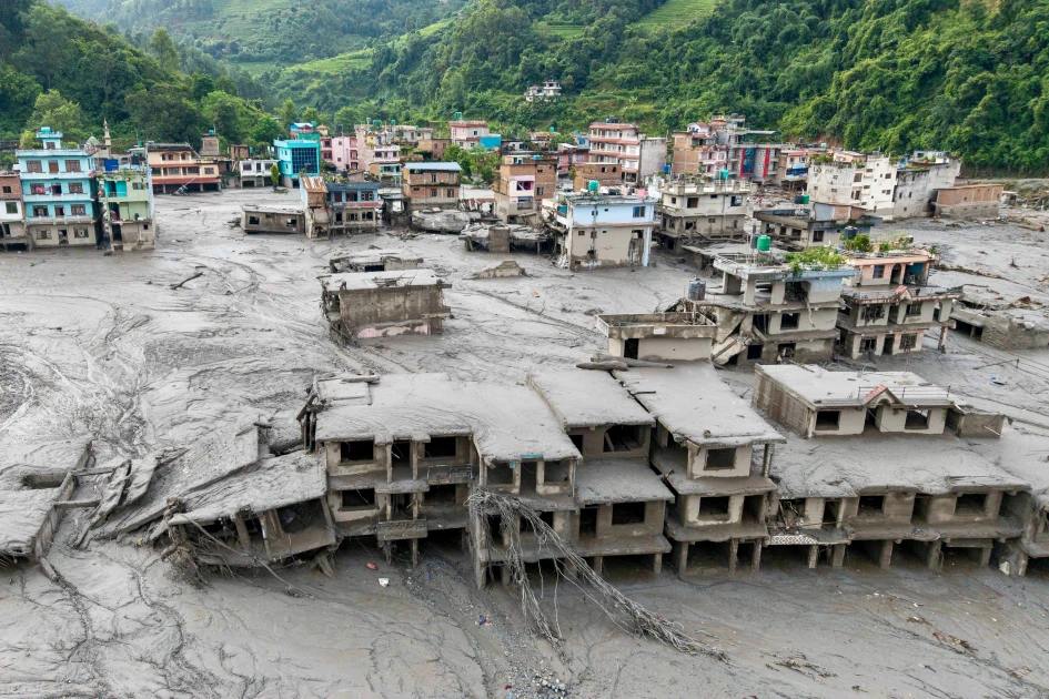
An aerial view shows houses lying deluged in sludge after flash floods at Devighat, Bidur Municipality in Nepal's Nuwakot district on August 27, 2026. Nepal's disaster agency said that 823 people remained out of contact on August 27, more than 24 hours after a deadly flood tore through the border region with Tibet.

Audio By Vocalize
The agency said seismic activity initially reported as an earthquake "was instead a glacial collapse and debris flow" that "caused subsequent catastrophic impacts downstream".
At least 160 people were killed by torrents of water and debris that crashed downstream on either side of the Nepal-Tibet border, with hundreds reported missing in both areas.
The cause of the disaster was not immediately clear in the hours after it occurred early Wednesday, but Nepal's Foreign Minister Shishir Khanal had said an earthquake likely triggered a landslide, in turn blocking a river and sending water gushing downstream.
Other theories advanced included a glacial lake flood -- when a fragile debris wall holding back glacier melt collapses -- or an ice avalanche.
USGS said "a magnitude 5.2 seismic event occurred near the border between Nepal and China on Aug 26 at 8:37am local time."
"This event was initially reported as a magnitude 4.4 earthquake. Additional analysis of nearby seismic stations, long period seismic waves, and satellite imagery led to the determination that the seismic event was instead a glacial collapse and debris flow, and that no earthquake had occurred."
Join the Discussion
Share your perspective with the Citizen Digital community.
No comments yet
This discussion is waiting for your voice. Be the first to share your thoughts!