Tropical Cyclone Hidaya: What we know so far

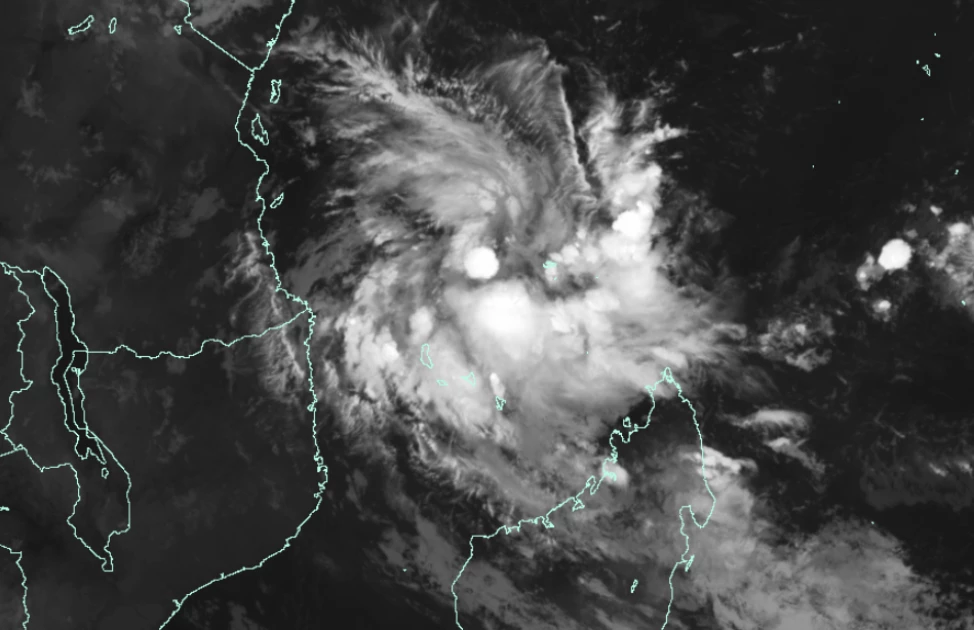
A tracker of the Tropical Cyclone Hidaya. PHOTO | X: Met Office Storms

Audio By Vocalize
The government of Kenya on Thursday warned that the Coastal region is likely to be hit by a tropical cyclone now christened ‘Hidaya’ within the next few days.
A Cabinet despatch seen by Citizen Digital indicated that the cyclone may bring with it heavy rainfall, large waves and strong winds that could affect marine activities in the Indian Ocean.
Tropical Cyclone Hidaya is said to have
developed over the South Indian Ocean, east of Tanzania and north-northeast of
Comoros, on Wednesday.
It was
designated the name ‘Hidaya’ by the Meteo France La Reunion, with forecast models
tracking it west-northwestward between May 2-4, 2024.
This as the Tanzania
Meteorological Authority (TMA) predicted that Cyclone Hidaya would be also approaching
the country’s Coast between Thursday and Monday.
According to Crisis24
publication, the tropical storm will become moderate while passing north of
Tanzania’s Mafia Island, before taking a “turn to track north-northwestward as
it approaches the eastern Tanzania coast late May 4 and will likely dissipate
into a zone of disturbed weather as it passes between Unguja Island and the
mainland May 5.”
The TMA has since issued an
advisory to residents of Coastal areas likely to be affected by the cyclone, noting
that there will be heavy rains and strong winds.
"The presence of ‘Hidaya'
near our country's coast is expected to dominate and affect the weather systems
of the country, including causing periods of heavy rain and strong winds in
some regions of the Mtwara, Lindi, and Pwani (including the Mafia Islands),”
the TMA said in a statement.
“Dar es Salaam, Tanga,
Morogoro, Ugunja, and Pemba regions and neighboring areas, especially on May 3,
2024, for the southern coastal areas (Lindi and Mtwara) and spreading to other
coastal areas from May 4 to 6, 2024.”

Join the Discussion
Share your perspective with the Citizen Digital community.
No comments yet
This discussion is waiting for your voice. Be the first to share your thoughts!