
Surveyors board, universities mull training reforms to meet emerging industry needs

Audio By Vocalize
The meeting held on Thursday at the Kenya School of Monetary Studies, brought together universities offering Surveying, Geomatics Engineering and Geospatial Engineering programmes, alongside representatives from the Kenya National Qualifications Authority (KNQA), the Council of Governors (CoG), the Director of Surveys, Board Members and the Secretariat to deliberate on the future of geospatial education and professional Practice in Kenya.
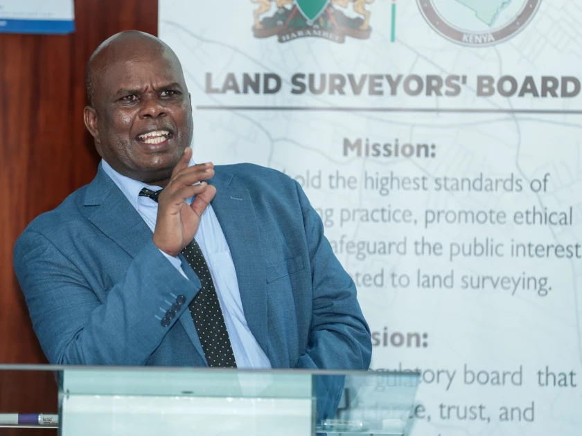
The Chairman of the Land Surveyors’ Board, Mr. Maritim Weldon, commended universities for their critical role in producing the next generation of geospatial professionals and reaffirmed the Board’s commitment to strengthening collaboration with institutions of higher learning.
"The surveying profession today extends far beyond land subdivision. Surveyors and geospatial professionals are at the centre of land administration, infrastructure development, environmental conservation, urban planning, natural resource management, disaster risk management and national development. Our responsibility is to ensure that graduates entering the profession possess the knowledge, skills and ethical standards required to serve the country effectively," said Maritim.
He noted that land, as defined under the Constitution of Kenya, encompasses the surface of the earth, subsurface resources, water bodies, marine areas, natural resources and airspace, making surveying and geospatial engineering indispensable to Kenya’s development agenda.
The Chairman further explained that while the Commission for University Education (CUE) is mandated to accredit and assure the quality of university programmes, the Land Surveyors’ Board is responsible for recognizing programmes for professional registration and licensing, regulating professional practice and safeguarding public interest.
He called for closer collaboration between universities, regulators and industry to ensure students are adequately supported from admission through to professional registration.
The Director of Surveys underscored the growing importance of geospatial technologies in driving national transformation.
"Surveying is no longer confined to measuring boundaries. Today, geospatial information powers infrastructure development, digital land administration, disaster preparedness, environmental management and climate resilience. As technology continues to evolve, our universities must produce graduates who are innovative, globally competitive and equipped with practical skills to solve real national challenges," he said.
He added that the consultative forum marked an important milestone in aligning academic training with industry needs.
"Strong partnerships between universities, regulators and practitioners will ensure that graduates enter the profession with the competencies required to support Kenya's digital transformation and sustainable development."
Representing the participating universities, Dr. Malachi Odongo of the Technical University of Kenya welcomed the consultative approach adopted by the Board, describing it as a significant step towards strengthening professional education.
"Curriculum development cannot happen in isolation. Continuous engagement between academia, regulators and industry ensures that graduates possess competencies that meet professional standards while responding to emerging technologies and the evolving needs of society," he said.
He further noted that a harmonized framework for programme recognition and professional progression would enhance graduate mobility, strengthen public confidence and improve the global competitiveness of Kenya's geospatial professionals.
During the meeting, participants extensively deliberated on the Board’s Draft Policy on Recognition and Accreditation of Surveying, Geomatics and Geospatial Engineering Programmes for purposes of registration and licensing. Universities submitted recommendations that will be incorporated into the policy before its finalization.
Participants further proposed the establishment of an Association of Surveying and Geospatial Engineering Chairpersons, bringing together heads of departments from universities offering surveying, geomatics and geospatial programmes.
The association is expected to promote continuous dialogue, curriculum harmonisation, research collaboration and stronger linkages between academia, industry and professional regulators.
Among the key resolutions was the need to harmonise the naming of Surveying, Geomatics Engineering and Geospatial Engineering programmes across universities. The proposed association will submit recommendations within three months for consideration by the Board as part of the ongoing legal and policy reforms.
The universities also recommended a review of the Survey Act to ensure it reflects global developments in surveying, geomatics and geospatial engineering practice, including advancements in Artificial Intelligence (AI), Geographic Information Systems (GIS), drone mapping, satellite imagery, remote sensing and digital spatial technologies.
The consultative meeting comes at a time when Kenya is accelerating digital land administration through Ardhisasa, expanding infrastructure development, strengthening the National Spatial Data Infrastructure and increasingly relying on geospatial technologies to support climate resilience, environmental conservation, urban planning and disaster risk management.
These developments have heightened demand for highly skilled geospatial professionals equipped to meet emerging national priorities.
Maritim urged universities to embrace innovation and continuously review their curricula to remain responsive to emerging technologies and the changing needs of the profession.
"The future of surveying lies in innovation, collaboration and continuous learning. By working together, we will produce professionals capable of supporting Kenya's development aspirations while upholding the highest standards of professional excellence," he said.
The Board reaffirmed its commitment to working closely with universities, CUE, KNQA, the Council of Governors and other stakeholders to strengthen professional education, improve graduate competence and build public confidence in Kenya’s surveying and geospatial profession.
Join the Discussion
Share your perspective with the Citizen Digital community.
No comments yet
This discussion is waiting for your voice. Be the first to share your thoughts!