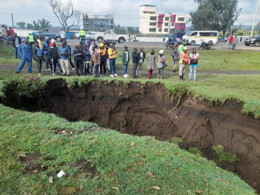
Heavy rains trigger new sinkholes in Nakuru West as geologists warn of unstable ground

Videos circulating online showed curious onlookers gathering around a large sinkhole that was gradually filling with rainwater.

Audio By Vocalize
Videos circulating online showed curious onlookers gathering around a large sinkhole that was gradually filling with rainwater.
This latest incident is part of a broader pattern. In May of this year, prolonged heavy rains caused the displacement of over 500 families in Kaptembwa, as massive sinkholes and fissures destroyed homes and devastated vast areas of land.
The aftermath caused significant cracks in houses, and others were submerged. One landlord reported losing 16 houses overnight.
Nakuru, located within the Great Rift Valley—a region extending from the Horn of Africa to Mozambique—sits on some of Africa's most unstable soils, according to geologists.
Dr. Clement Lenashuru, a Natural Research Scientist, told Citizen TV that the area's instability is due to volcanic activity that occurred during the formation of the Rift Valley, leaving a layer of pumice or volcanic ash covering numerous fault lines.
"Beneath the surface, the region is composed of loose ash sand that can be easily washed away with water percolation," Dr. Clement noted.
Dr. Clement went on to explain that the Rift Valley's fault lines are not uniform in size, which contributes to the frequent formation of sinkholes, particularly during heavy rains or poor drainage.
Soil Scientist Grace Ruiru attributes the formation of fissures and sinkholes to the active movement of tectonic plates in the region.
She also noted that Nakuru's sandy soil composition, which does not retain water, exacerbates these geological issues.
Geologists have repeatedly warned that the rapid construction of skyscrapers in Nakuru could be a disaster waiting to happen, as the unstable ground may fail to support the weight in the event of a natural disaster such as a landslip or an earthquake.
"Such buildings are at risk of sinking, cracking, or sustaining severe damage," Dr. Clement warned.
In 2020, a study was conducted to identify Nakuru's major fault lines and determine which areas are most vulnerable.
Although detailed findings are limited, geologists have identified Shabab, London, Kaptembwa, Kiamunyi, and Ngata in Nakuru West, as well as Gilgil and Suswa, as potential weak points.


Leave a Comment